Residential Construction Statistics (RCS)
Track the pace of construction and plan strategically with up-to-date figures from across home building.

Spot trends. First.
Take advantage of the most in-depth residential construction information available with our Residential Construction Statistics self-service portal. With unparalleled data from around one million NHBC inspections every year, it’s quick and easy to access must-know stats, including:
- registrations – when a developer has registered their intent to build a new home
- starts – when the construction of a home begins
- completions – when a plot has been signed off by NHBC and is ready to be sold
- key stage inspection – the number of houses and apartments reaching start, superstructure, first-fix and pre-handover stages.
Tap into market intelligence
Comprehensive catalogue
Our RCS data spans back to 2007, with detailed breakdowns to help you customise, analyse and strategise.
Get granular
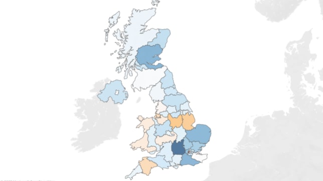
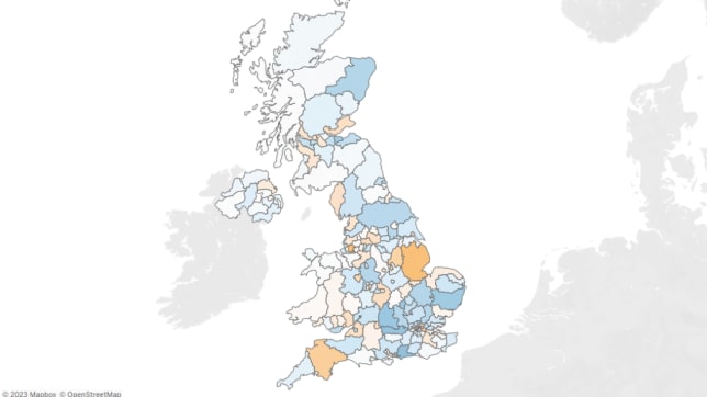
View at a nationwide level or filter from up to 170 UK regional areas.
Fresh and ready
Data refreshes automatically on a daily basis to keep you informed.
Visualise clearly
Make the complex simple with easy-to-understand graphs and charts directly in the portal.
Export fast
Extract the data you need directly into Excel, PowerPoint or PDF to save you reporting time.
Multiple logins
Add more user licences for convenience with a 75% discount for each additional subscription.
Affordable at scale
Choose the access level that’s right for you and grow your data capabilities with a 75% discount on every additional RCS subscription at the same or a lower level.
Core
£2,100 per year (ex VAT)
• One user
• Monthly data
• ITL 2 (around 40 UK geographical breakdowns)
Enhanced
£2,625 per year (ex VAT)
• One user
• Monthly data
• ITL 3 (over 170 UK geographical breakdowns)
Pro
£3,675 per year (ex VAT)
• One user
• Weekly data
• ITL 3 (over 170 UK geographical breakdowns)
International Territorial Level 2
(ITL) 2
International Territorial Level (ITL) 3
(ITL) 3
International Territorial Levels (ITLs) are a standard for referencing the geographical sub-divisions of the UK for statistical purposes, used by the Office for National Statistics (ONS). ITL 2 divides the UK into about 40 areas with population ranges between 800,000 and 3,000,000. ITL 3 is even more detailed, dividing the UK into over 170 areas with population ranges between 150,000 and 800,000.
Frequently asked questions
-
NHBC has the broadest market share of UK new build construction. Information is gathered directly from developers and builders, and by over 300 inspectors visiting sites and homes regularly throughout construction. You can rely on NHBC data because it underpins our insurance and technical risk management processes and is critical to our business.
-
NHBC’s proprietary data is available to you at three subscription levels. Data can be shared within your organisation for internal use. Each licence provides a login to the platform for a single user. Discounts are available for multi-user and multi-year subscriptions. Please enquire below to discuss your organisation’s needs.
-
Yes, exports of data are available in both CSV (comma separated variable text files) or in Excel format. In addition, visuals (e.g. charts) can be easily exported as an image, PDF or PowerPoint.
-
All data in Residential Construction Statistics is aggregated. Our Pro package, which includes weekly ITL-3 data, offers the most detailed view.
-
Each user can create personal custom views that save their filters, sorts, drill-downs or selections, making them available at the click of a button. Custom views can also be made the default view for each tab. In addition, a user can choose to subscribe to a report or custom view. Subscriptions email an image or PDF snapshot of a view or workbook at regular intervals.
-
The data can be segmented by year, quarter, month, or week, depending on your subscription. Geographical breakdowns are provided for the UK countries, as well as International Territorial Levels (ITL) 1, 2, and 3. Additionally, all subscription packages provide access to breakdowns of registrations, starts, and completions by sector, dwelling type, construction type, and developer size. The data includes absolute home figures, percentages within a specific date range or geography, and mean or median proposed and actual selling prices.
-
Yes, we also offer bespoke reporting to suit your data needs. For more information and to enquire about this service, click here.
-
No, there is no automatic subscription after taking a free trial. You do not need to remember to cancel. Your trial access expires after seven days.
Our other data services
Everything you need to know about your homes and the industry made simple

Your Build Data
A wealth of detail about your sites, claims and more. Available via a data feed or dashboard to provide you with insights, fast.

National New Homes Survey
Find out what homeowners really think with satisfaction insights on an unrivalled scale and benchmarking against your rivals.

Data Consultancy
Tailored solutions created just for you by the experts to give you the insights you need.